For us sailors, weather is a big part of our concern. This is also true for our families and friends who are still on the ground following our journey. This is why the Skipperblogs' tracking map includes weather data to better reflect navigation conditions.
Windy as map background
With Premium and Pro plan, you can use Windy weather map as background for your tracking map. Wind, temperature and pressure layers can be displayed on your website, and the weather picker allow your visitor to get details on a specific location.
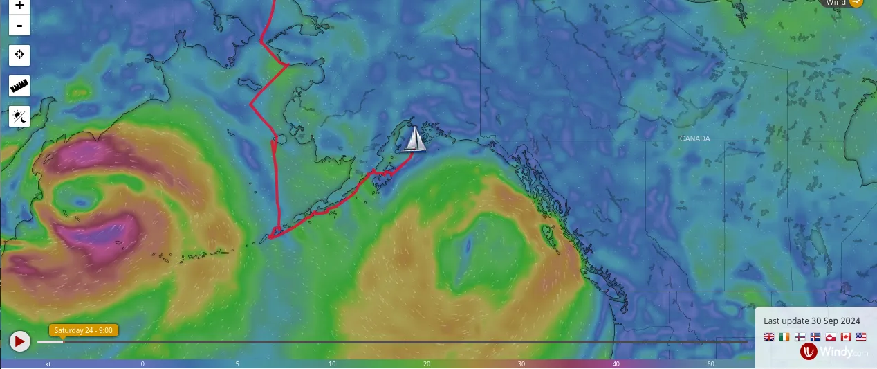
To use Windy.com weather on your Skipperblogs map, please refer to this how-to: https://www.skipperblogs.com/support/kb/map/create-an-api-key-to-display-windy-weather-as-the-live-map-background
While Windy.com displays actual and forecasted weather, the data becomes less relevant for the past track. That is why weather is also recorded in waypoint.
Weather on waypoints
When using trackings, the system queries a weather service with the provided coordinates and add the corresponding weather data to the waypoint. This process is automatic and is not available when manually editing the map track.
The sky condition is displayed as an image while the wind, pressure and temperature are displayed as figures.
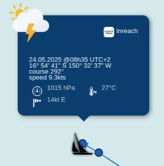
This way, when looking over your track months or years later, you and your family can relive your adventures with more details.