On Skipperblogs, you can import GPS tracks from .gpx file on your map. GPX is the abbreviation of GPS eXchange and contains longitude and latitude location data that may include waypoints, routes, and tracks. Many devices and online services use this file format for GPS data exchange; other formats can be used, such as KML.
Import a .gpx file
Go on the page DashboardNavigation Map
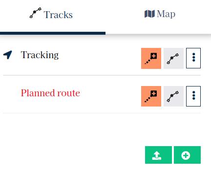
Below the track list (left block), click on the green import button

A file explorer will open; select the file you want to upload. The system will load the file and preview the trace on the map. You can then check the data before import.
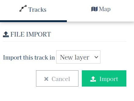
You will have the choice to import the data in a new layer or in an existing trace. If you choose to import the points into a new layer, you can subsequently merge this new trace into another. That way you can modify the data before merging it in an existing trace.
If you choose to import the data directly into an existing trace, the points will be added at the end of the trace.

Once the import destination is selected, click Import. Your browser will then upload the file to the server and the page will reload once the import is complete.
Predictwind tracking
![]()
It is possible to import a trace from the PredictWind tracking service. To do this, ask the PredictWind customer service to send you your track in .gpx. format. You can then import it on your Skipperblogs map.
KML files (Google Maps/Earth)
KML files cannot be imported directly. You can use the online service https://kml2gpx.com/ to convert your file to .gpx format, before uploading it to your Skipperblogs map.
If you encounter issues during this process, please contact the support providing your file.